Digital Terrain Model
Digital Terrain Model of Terschelling Island
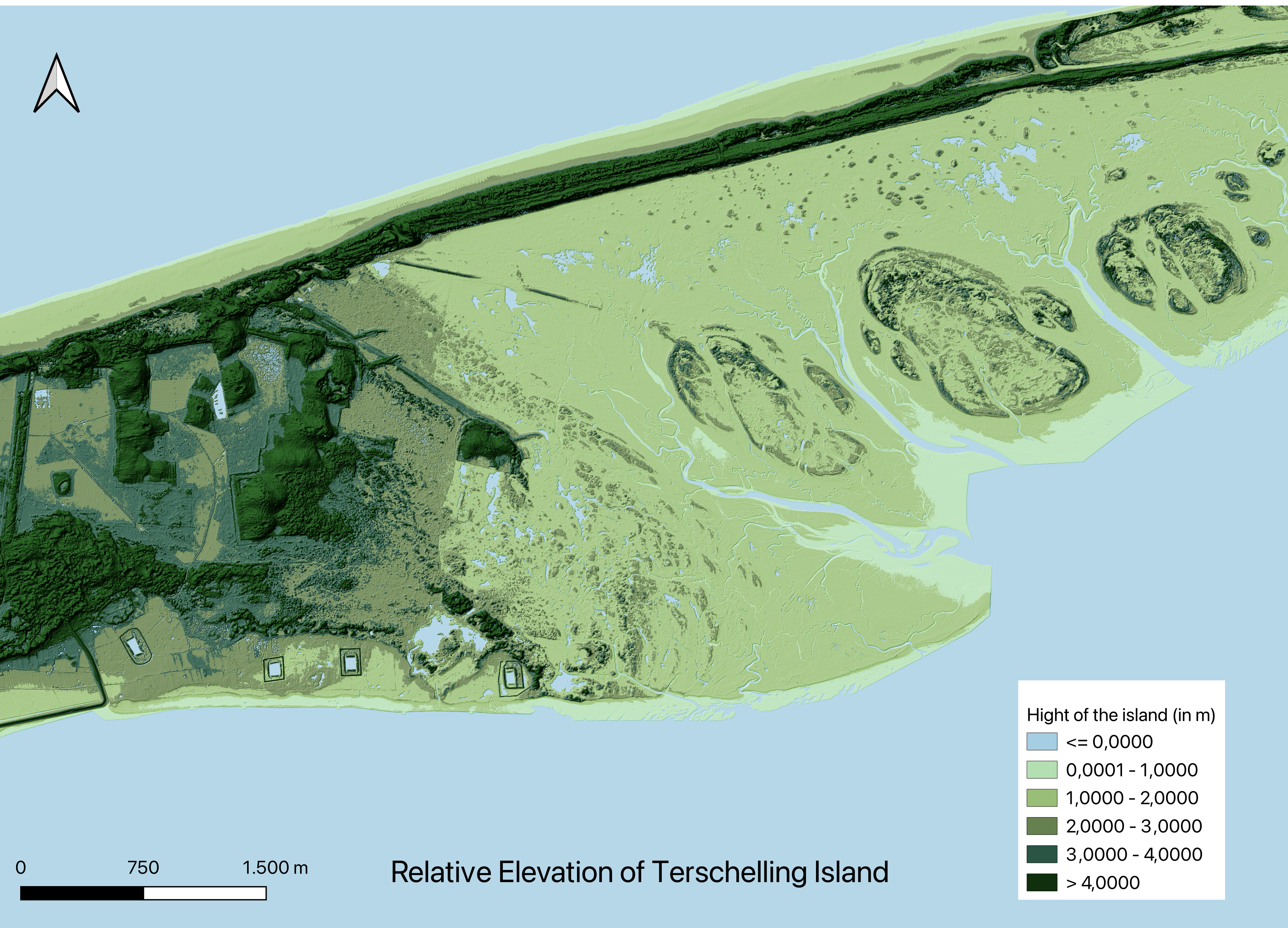
The area that I chose is the island of Terschelling in the north of the Netherlands. I chose this area because it has an interesting river flowing to the sea and notable topography. Indeed, there is an elevated part of this island in the north and on the west that is visible on the map in dark green.
To make this map, I downloaded the data from the website GeoTiles. I imported it into QGIS and merged all the DTM (Digital Terrain Models). T
I chose this color scheme to have the sea in blue and to show the elevation of the ground on the island in different shades of green. I noticed that the northern and western parts of the island are higher than the rest of the island and that the rivers are in the lowest part of the island, where the elevation is a maximum of 2 meters higher than sea level. This map shows how, if the sea level rises by more than 1 meter, the whole eastern part of the island would be underwater.